Antarctic Diaries 2012 - Part 2
Saturday 25th February
On board the ship.
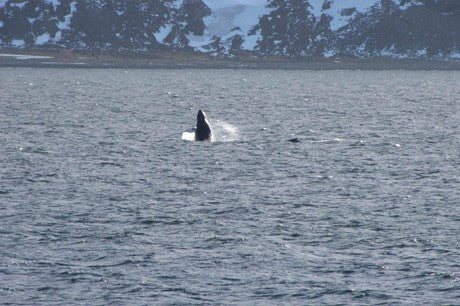
Last night the ship again ran into a wall of ice in Antarctic Sound and had to turn back north again. The most recently acquired satellite radar image shows that the area is choked with solid pack ice and is impenetrable. The ship’s company therefore decided to sail to King George Island to recover a tide gauge, before heading to Deception Island for two days of hydrographic surveying and levelling. We are hoping that the westerly gales forecast for Sunday will clear the pack ice from Antarctic Sound, allowing us passage to James Ross Island on Tuesday. In the meantime, humpback whales are breaching nearby, and we all spent a while on the upper deck, trying to photograph their dramatic breaches.

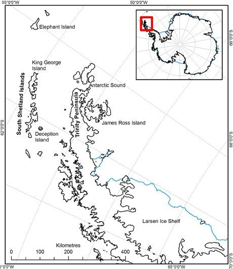
Location Map. Showing the main visiting spots of Elephant Island, Deception Island, Antarctic Sound and James Ross Island.

Sunday 26th February
On board the ship.
Whilst sailing to Deception Island yesterday, smoke was spotted on King George Island from the bridge. Contact with Jubany Station indicated that there had been a fire at the Brazilian base, Comandante Ferraz, in Admiralty Bay. We sailed directly into Admiralty Bay to offer any assistance possible. Upon arrival, we found that all personnel had been evacuated, but tragically there had been two fatalities. However, the fire was still burning, dangerously close to a fuel depot. The ship’s company therefore spent most of yesterday successfully fighting the fire.
The plan for today is to remain in the area throughout the day with a Sunday routine, which means a relaxed day for the sailors, who are all tired after a busy day yesterday fire-fighting. We sail to Deception Island overnight for two days hydrographic work, and then hopefully on to James Ross Island. We are worried about the weather; this time last year we were mostly confined to our tents with bad weather, so even if we get to James Ross Island, we may be unable to do any work.

Whalers Bay - Deception Island
Monday 27th February
On board the ship.
This morning we sailed into the natural harbour of Deception Island. It was grey and snowy and miserable, so unfortunately there was little to see. Deception Island is the crater of a caldera volcano. It is approximately circular, with a narrow opening through which ships can pass. As we passed very close to Cathedral Crags, the hydrographers were busy keeping an eye on rock spikes below the sea surface, which are the remnants of volcanic vents. We are now in Dynamic Positioning mode near an abandoned British research base (‘Base B’) an old Norwegian whaling station in the appropriately named Whaler’s Bay). Many of the beaches around Deception Island are volcanically heated, with curtains of steam forming above them at low tide. Typically these beaches are 20-40°C, but a few fumaroles are super-heated to 103-107°C. The volcano was particularly active during the nineteenth century, with eruptions in most decades, but there were only two periods of eruptions during the twentieth century. Deception Island volcano will almost certainly erupt again.
Human occupation began on Deception Island from 1820, as a sealers’ harbour, and later as a base for whaling ships. Deception Island played an important role in the Second World War during Operation Tabarin in 1944. This project was designed to destroy the abandoned stocks of coal and whale oil in the whaling station, so that German raiders could not refuel. At the same time, they built a new base for British scientists, called ‘Base B’. This re-established British presence in Antarctica in support of the UK’s claim to territory. Base B was occupied continuously until the first eruption in 1967. It was severely damaged by floods related to another eruption in 1969, and was subsequently abandoned.
The aim is to remain here for two days, to allow the hydrographers to collect tidal data. Then it is back to James Ross Island for a third and final attempt at deployment on Thursday.
If you missed the first instalment you can check out Antarctic Diaries-Part 1Or move on to Part 3


