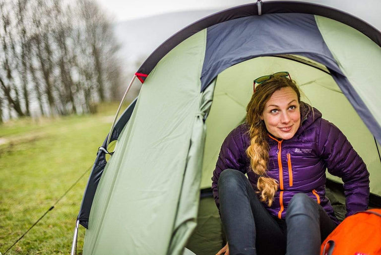
Bethan Davies and a team of scientists are heading to the Antarctic Peninsula
In a new series of reports, we will be following a small team of scientists as they head off down to Antarctica to do some sciency type stuff. I don’t know if they will be taking bunsen burners and conical flasks, but they will most probably have a microscope. Here we meet Bethan Davies. Dr Bethan Davies.
Col:
So, Bethan, you’re a new addition to Alpkit, and we’re sponsoring you to go to Antarctica in January 2011. Perhaps you can tell us who you are and why you’re heading South for Winter.
Bethan:
Hi Col. I’m a member of a team led by Aberystwyth University, and we have a NERC (Natural Environment Research Council) grant to go to the northern Antarctic Peninsula, to James Ross Island in particular (right at the NE end of the Peninsula), to study the effects of oceanic and atmospheric warming on the glaciers there. Our team consists of Professors Neil Glasser and Mike Hambrey from Aberystwyth, Prof. John Smellie from Leicester, and Dr Jonathan Carrivick from Leeds University. Neil, Jonathan, myself, and a field assistant will be going South.
Col:
Why is the Antarctic Peninsula an important region to research?
Bethan:
The Antarctic Peninsula is one of the fastest-warming places on Earth. Compared to a global average of 0.6°C warming per century, it was warmed by 2.5°C since 1950. We are greatly concerned about the long-term viability of ice cover in the Antarctic Peninsula. The disappearance of ice cover from this pristine region has implications for sea level rise, wildlife, and krill (which feed the large stocks of fish on which we depend).
As the atmosphere warms, the thermal limit of ice shelves (-9°C annual average) is moving further south, resulting in the rapid and dramatic collapse of ice shelves. We worry about that, not only because it has the potential to raise sea levels, but also because it cools the ocean and impacts on oceanic circulation. The IPCC (Intergovernmental Panel on Climate Change) has highlighted the Antarctic Peninsula as one of eight key global regions requiring intensive research.
Col:
But Bethan, even I know that floating ice doesn’t raise the water level.
Bethan:
Ice shelves are different to floating sea ice. Ice shelves are largely created by snow fall on the higher glacier on land. The glacier moves downhill under the force of gravity, eventually going into the ocean, where it becomes rapidly deeper. The glacier starts to float (what we call a tidewater glacier). Several tidewater glaciers may come together, in a bay for example, forming a much larger ‘ice shelf’. If this ice shelf rapidly disintegrates, then it adds water (in the form of melting ice) into the ocean, directly rising sea levels. But it doesn’t end there. Most ice shelves are ‘pinned’ into bays, forming ‘backstress’ on the glacier above, preventing it from sliding into the ocean under the force of gravity. After the collapse of ice shelves, glaciers on the Antarctic Peninsula have accelerated, thinned, and retreated, rapidly lost mass to the oceans, again rising sea level.
Col:
OK, fine. But the Antarctic Peninsula is very small. How much can it possibly rise global sea level by?
Bethan:
The IPCC best guess is that global sea levels will rise 1 m by 2100. That’s mostly due to thermal expansion of the oceans and includes no estimate of input from changing glacier dynamics. We estimate 0.6 m of sea level rise locked up in just the Antarctic Peninsula alone. It is important to research this region, to determine the likelihood of a large increase in sea level rise from this region, to predict its timing, and to provide data for glaciological modellers. Ultimately, the scientific community wishes to provide better estimates of future sea level rise to governments and stakeholders, to allow better planning and mitigation policies to develop.
Col:
Now there’s a lot of sea out there, how would you measure sea level rise?
Bethan:
There are many different methods of measuring global sea level rise. Satellite altimetry is the most accurate (where satellites know their orbit height and can calculate changes in sea level to a millimetre scale). There are tide gauge measuring stations anchored in tectonically stable regions worldwide. On a longer time scale, we are forced to use ‘proxies’, such as looking for evidence of changes in microscopic marine organisms in raised beaches, salt marshes, peat bogs, coastal lake sediments, drowned corals, etc.
Col:
So what will you be doing when you get to Antarctica? How are you preparing for your trip?
Bethan:
Firstly, I have satellite images and aerial photographs from the 1980s until the present day. I’m mapping the geomorphology from the air, as well as the changing glacier margins from the 1980s until present. By using repeat satellite images, we can also track changes in glacier velocity and thickness.
These images of James Ross Island are very interesting. As you can see, in 1988 a large ice shelf connected it to the Antarctic Peninsula. In 1997 it collapsed very rapidly, and retreat has continued, as you can see, until 2009. We want to know how tributary glaciers will respond to this collapse in this important region.

Col:
How can sediments and landscape tell you about past glaciers?
Bethan:
They can tell you in detail! Looking at ‘sediment-landform assemblages’, where we look at the geomorphology of an area and also at the sediments that make up the landscape, we can deduce information about glaciological styles, patterns of retreat, and even infer sub-glacial conditions, such as whether the glacier is frozen to its bed, or was at pressure-melting point. This allows us to assess the stability of the present ice sheet, and understand its subglacial conditions, a place no scientist can get to!
We can also use moraines to understand past configurations of the ice sheet, and flutings, eskers and drumlins to look at ice flow pathways. We’ll be taking rock samples and analysing their lithology to determine whether they are local, or from the Peninsula. This also helps us to determine former ice flow directions.
Col:
How can you date the rocks? I’m sure you will not be taking them down the local Italian.
Bethan:
We’ll try and collect dates from the region, to develop a chronology of retreat. Was this fast or slow? Smooth and steady or rapid and punctuated? How long has the current Antarctic Peninsula Ice Sheet retained its present configuration? We can collect organics from lake sediments for radio carbon dating. We will also collect samples from quartz-rich rocks for cosmogenic nuclide dating. Quartz crystals trap cosmogenic nuclides when they are exposed to the sun. We can count these, and determine how long the rocks were exposed for. Of course, we have to be careful that the rocks have not moved since they were deposited!
Col:
So once you get out there, other than fighting off Penguin’s and Skua’s, what will the conditions be like?
Bethan:
Well, the reason we’re going to James Ross Island is that it has one of the largest expanses of ice-free ground in Antarctica. Sedimentology and geomorphology is very difficult under the ice! As you can see from these photos of Mike Hambrey’s previous expeditions, it’s a strange landscape with no vegetation at all. It’s very likely to snow very heavily, and we’ve been told we’ll lose at least 1/3rd of our days to blizzards! Mainly, the weather will be very variable. We’re expecting everything from mild sun to gale force winds and blizzards.


Ooh looks nice.. So, what happens next?
Bethan:
We’re still consolidating our travel plans with the British Antarctic Survey, but I think we’ll fly to the Falkland Islands and be deployed to our field location by the RRV Ernest Shackleton. But next on our itinerary is the Girton Conference and the field training camp in September.
Col:
Excellent. I look forward to hearing how the preparation goes, perhaps you can come back and tell us about that in September. In the meantime, what can people read if they want to know more?
Bethan:
For further online reading, check out these websites:
Centre for Glaciology
Beth’s Quaternary Blog
British Antarctic Survey
British Geological Survey
Inter Governmental Panel on Climate Change
Glaciers
New Scientist
Real Climate
Good books include:
Nature’s Clocks: How Scientists measure the time of absolutely everything (MacDougall)
Glaciers and Glaciation (Benn and Evans)
Glacial Geology: Ice sheets and landforms (Bennett and Glasser)
Glaciers (Hambrey and Alean)
Antarctica: The Complete Story (McGonigal and Woodworth)
